






AviNavi, navigation for pilots

Description of AviNavi, navigation for pilots
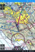
AviNavi is a navigation application designed specifically for pilots. This app provides essential tools for aviation navigation, including VFR, low-altitude IFR, and instrument approach charts for the continental United States. Pilots can download AviNavi on the Android platform to access a range of features that simplify flight planning and enhance safety during flights.
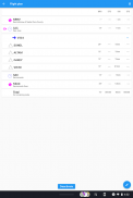
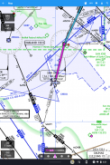
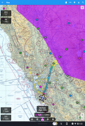
The application includes comprehensive flight planning capabilities. Users can input their flight plans directly into the app, either by selecting navigation points from a moving map or by entering text-based plans. For instance, entering a flight route like "KPAO SUNOL V334 SAC KSAC" will load the complete plan, including all relevant airway navigation points. This functionality is particularly useful for pilots who prefer flexibility in how they create and manage their flight plans.
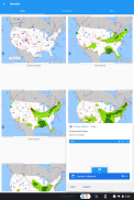
AviNavi also offers overlays for weather information, including Nexrad radar data, METARs, and AIRMETS/SIGMETS. These overlays can be applied to the map using the Layers button, allowing pilots to visualize weather patterns and conditions that may impact their flight. The app provides METARs and TAFs in plain English, making it easier for users to interpret vital weather data without needing specialized knowledge.
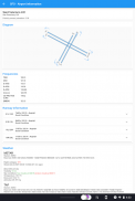
Detailed airport information is readily available within AviNavi. Pilots can access data on runways, frequencies, fuel availability, and current weather conditions for airports throughout the continental United States. This information is crucial for flight planning and can help pilots make informed decisions regarding their routes and destinations.
The app includes features that indicate the reachability of nearby airports in a no-wind glide scenario. Airports are displayed in either green or red, signaling whether they are likely reachable based on the current conditions. This feature provides an additional layer of safety, allowing pilots to evaluate alternative landing options quickly.
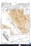
Instrument approach charts within AviNavi include a variety of important elements, such as airport diagrams, Standard Terminal Arrival Routes (STARS), Departure Procedures (DPs), and minimums. Each chart also comes with a legend to assist pilots in understanding the information presented. This comprehensive access to approach charts enables pilots to prepare adequately for landing at their intended destinations.
The weather information provided by AviNavi includes graphical and textual representations of METARs, TAFs, AIRMETs, SIGMETs, and Prog charts. Additionally, pilots can access Convective Outlook and Wind information for different times and altitudes. This variety of data ensures that users have the latest information at hand, which is crucial for safe flight operations.
AviNavi operates on a subscription basis, requiring users to choose between monthly or annual plans after a free trial period. This model allows pilots to evaluate the app's features before committing to a subscription, ensuring that they find value in the tools provided.
When utilizing AviNavi, pilots can benefit from the user-friendly interface that facilitates quick access to essential navigation tools and information. The moving map, which allows for easy searching and selecting of navigation points, is designed with the user experience in mind. This feature enables pilots to start direct-to navigation effortlessly or add points to their flight plans.
The app is designed for both experienced and novice pilots, providing tools that cater to a wide range of aviation needs. The straightforward navigation and information layout help users to focus on their flying tasks without unnecessary distractions.
By integrating various aviation resources into a single platform, AviNavi helps streamline the flight planning process and enhances situational awareness during flights. The combination of weather overlays, detailed airport information, and instrument charts makes it a valuable tool for pilots operating in the continental United States.
As pilots continue to seek efficient and reliable tools for navigation, AviNavi meets these demands with its comprehensive features and user-friendly design. The app ensures that critical information is always at the fingertips of users, enabling safer and more effective flight operations.
AviNavi stands out as a reliable navigation solution for pilots, combining essential features and a straightforward approach to flight planning. With the ability to download AviNavi on the Android platform, pilots can take advantage of these tools and enhance their flying experience.


